

Globe-Shaped Traveling Double Inkwell with Pen Wipe
Description
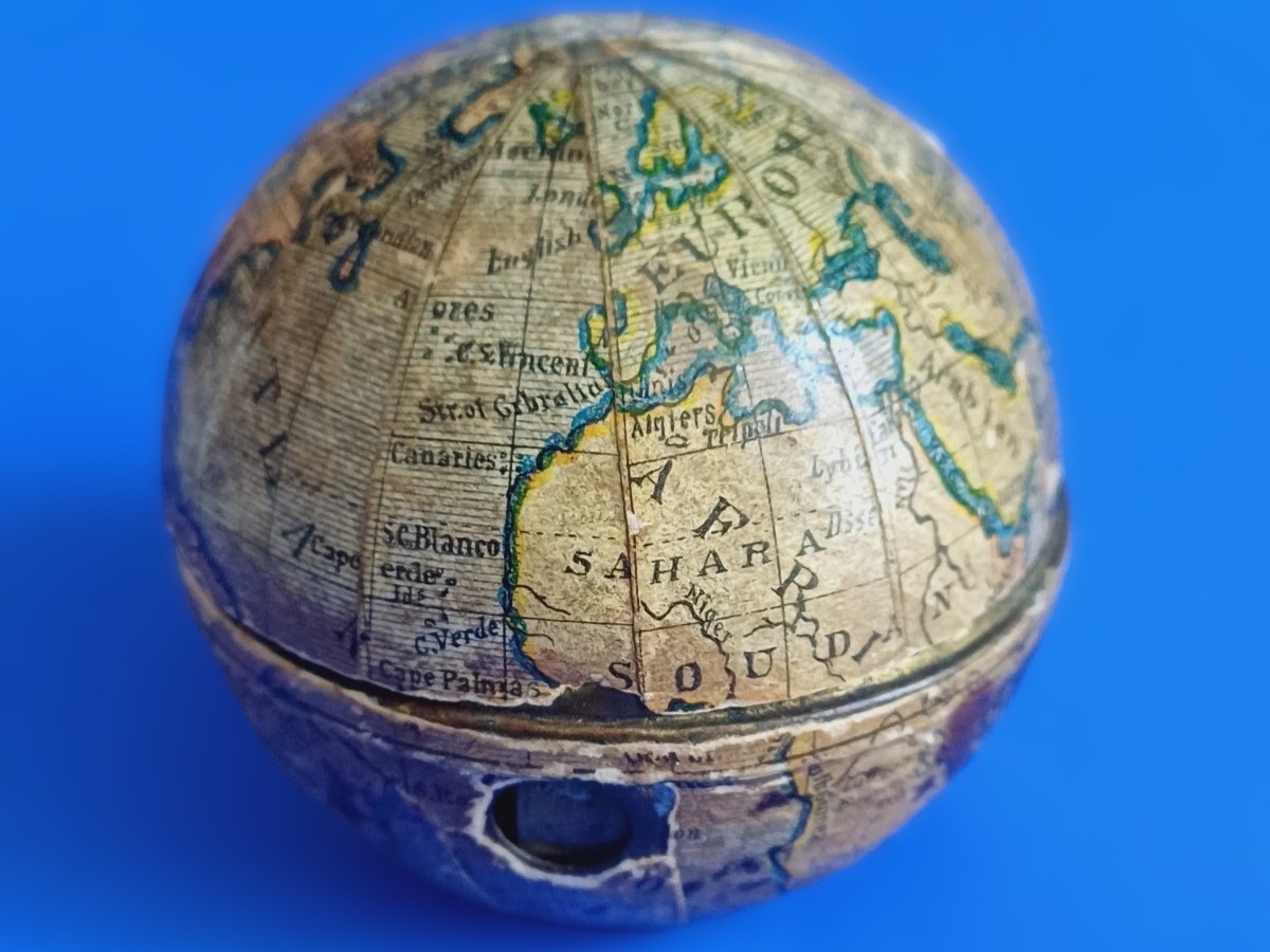
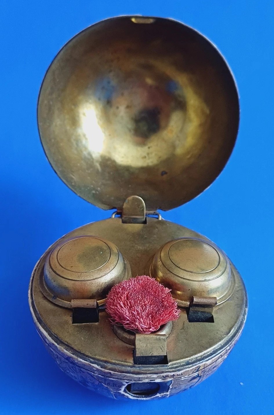
This terrestrial globe novelty traveling inkwell likely was produced in Germany or Austria around 1890 – 1895.
Exterior Construction
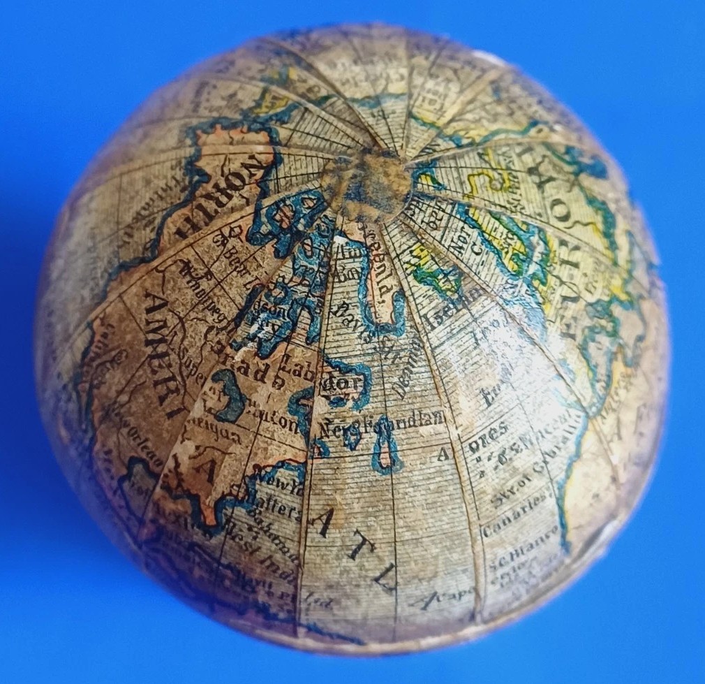
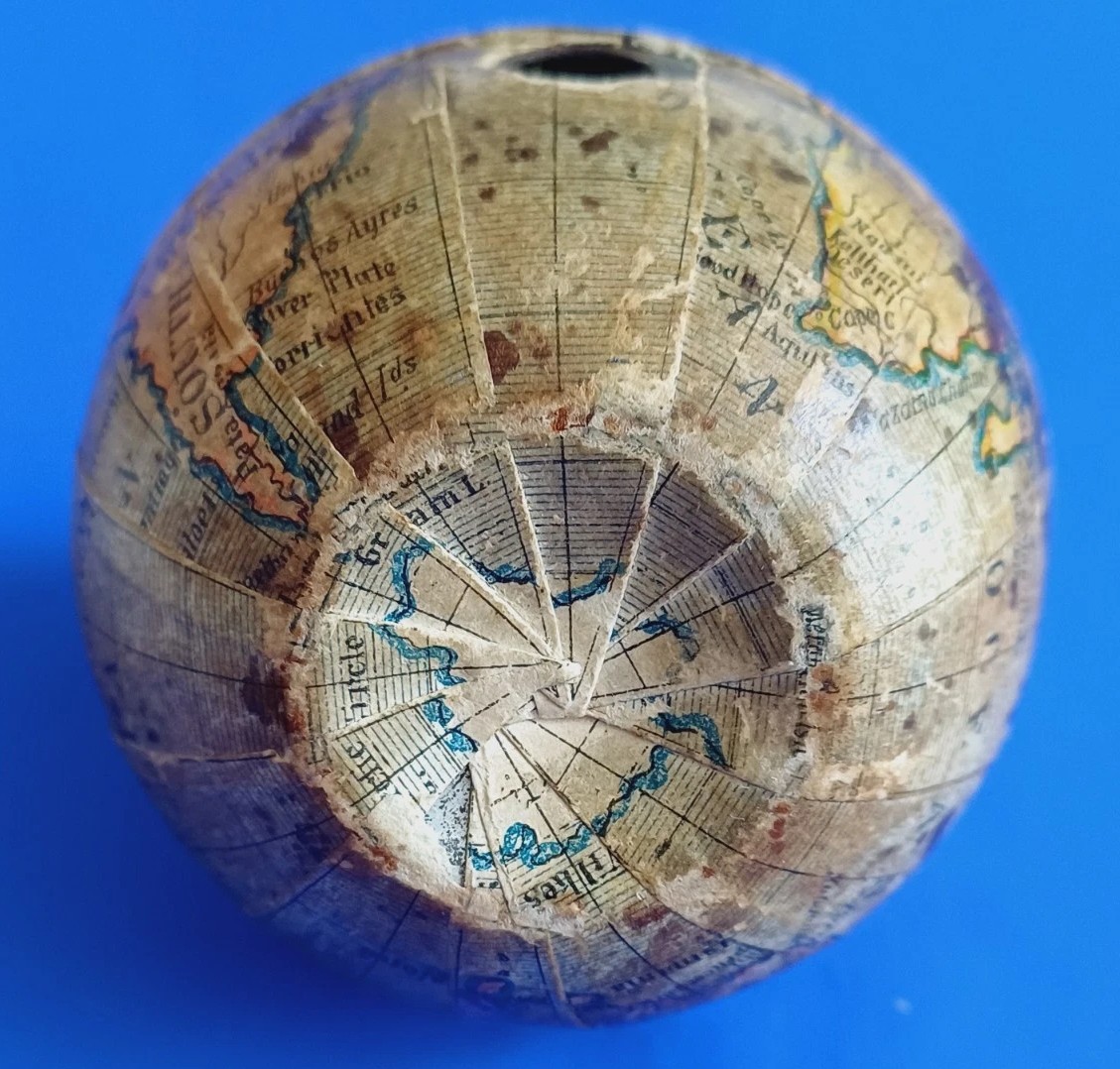
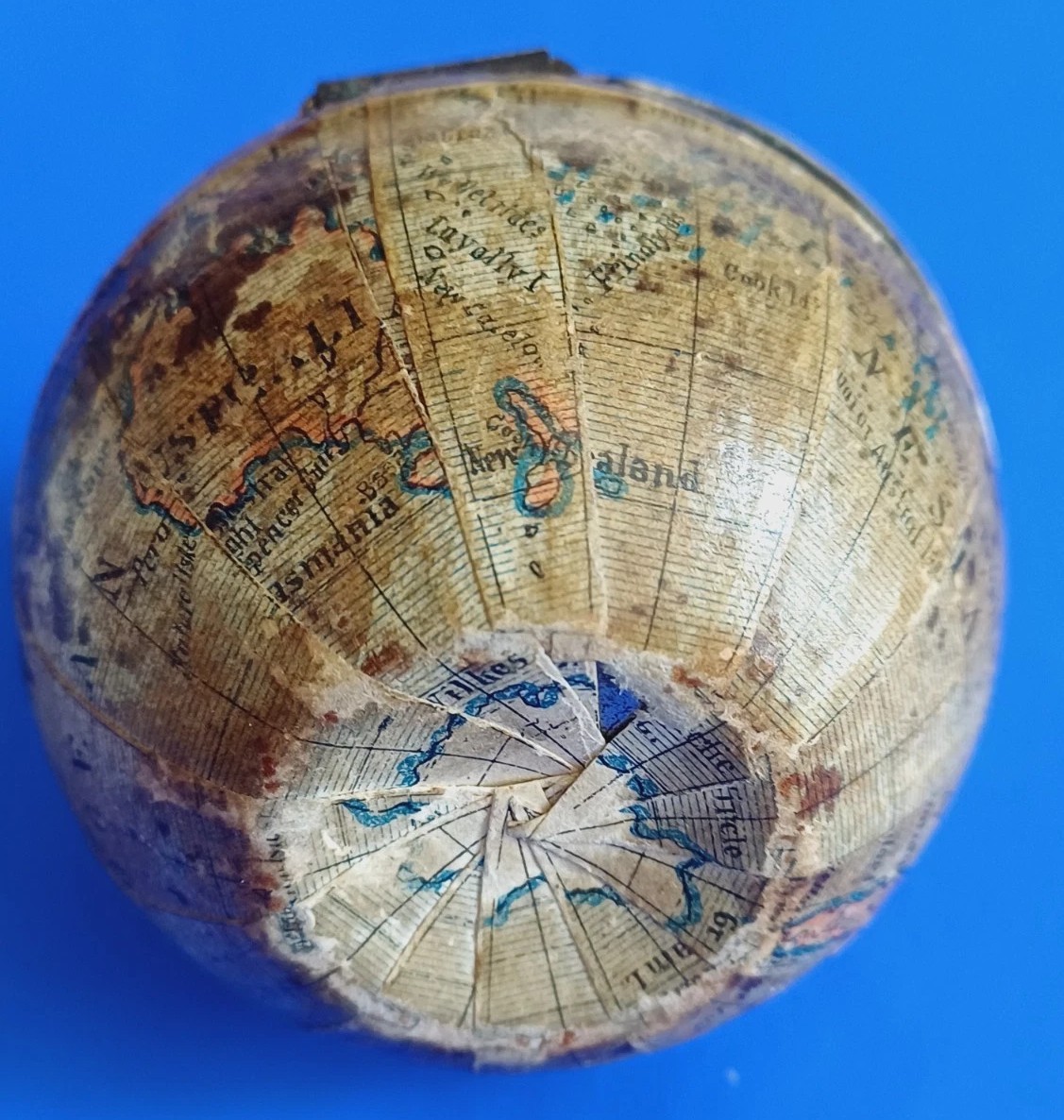
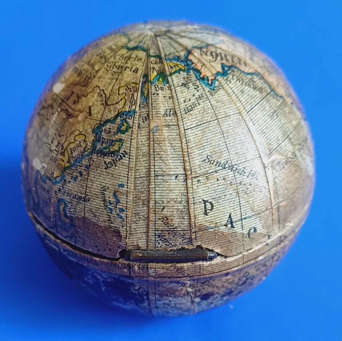
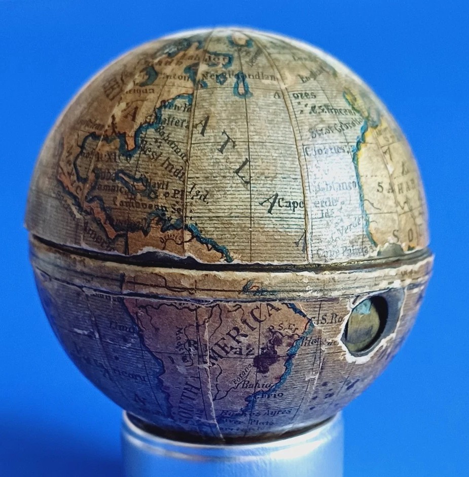
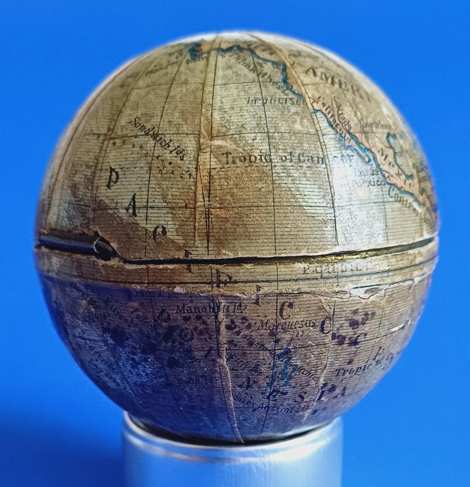
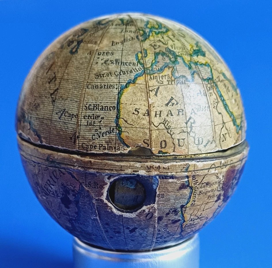
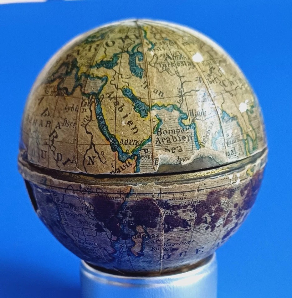
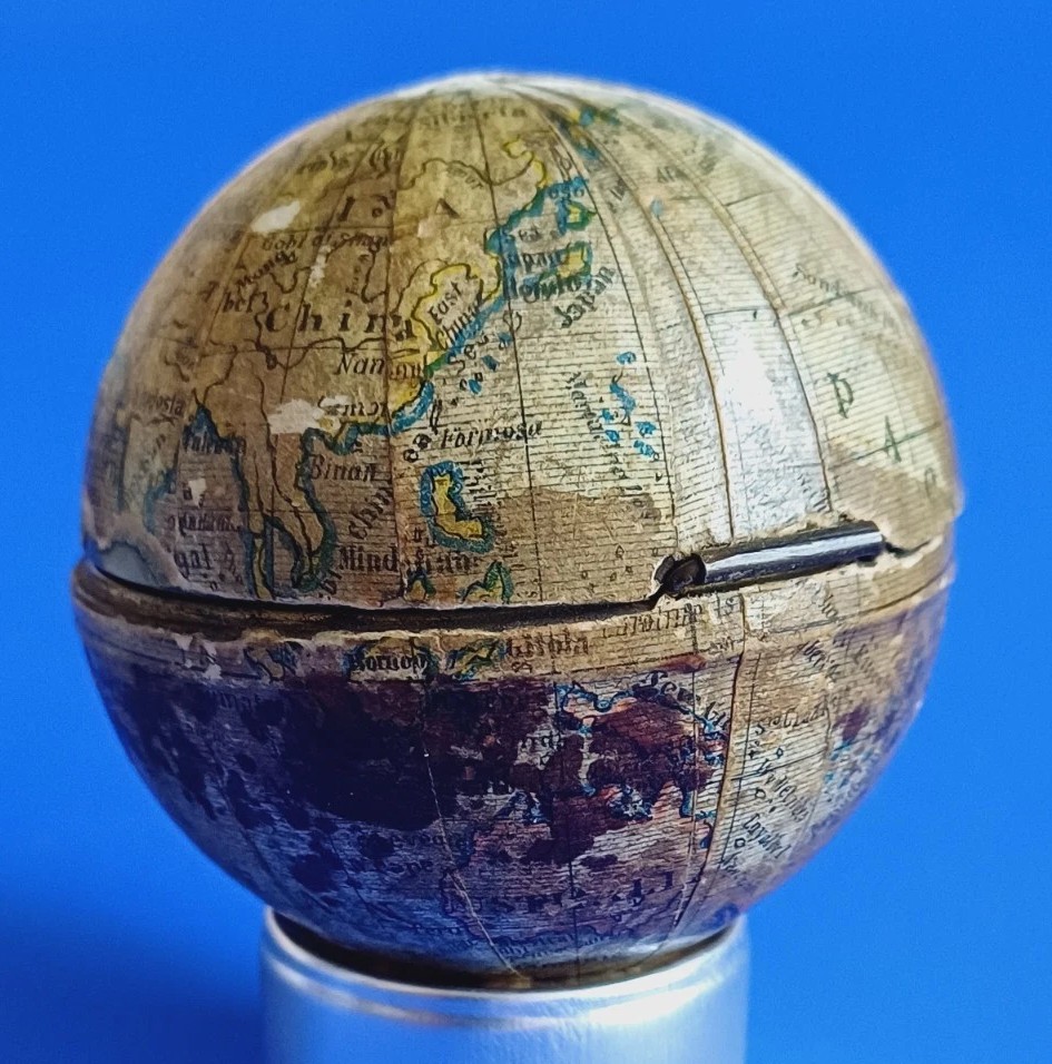
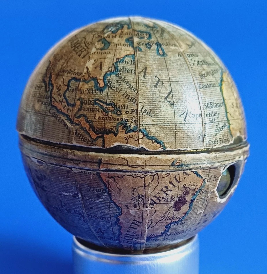
- Form & Casing: The inkwell features a spherical brass body meticulously covered in a series of lithographed paper map gores. The cartography uses English terminology (e.g., “North America”, “Atlantic”, “Arabian Sea”) printed on segmented panels tailored to fit the spherical contours of the case.
- Catch Mechanism: A flush, spring-loaded push button is set into the lower hemisphere near the equator line. Pressing this button releases an internal catch, allowing the top hemisphere to swing open on its rear leaf hinge.
Interior Features & Sealing Mechanisms
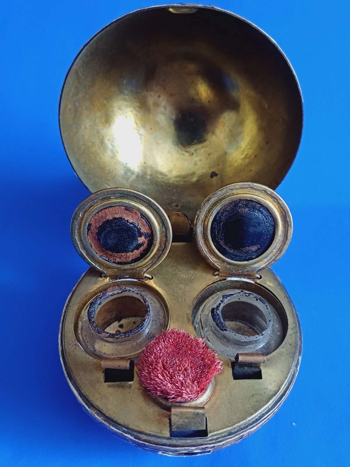
Opening the main case reveals a polished brass insert deck dividing the sphere. It contains two independent inkwells flanking a central round bristle pen wipe.
- Dual Hinged Lids: Rather than a single cover, each clear-glass ink bottle is protected by its own dedicated brass cap on a rear pivot hinge.
- Spring-Loaded Tension System: Rather than internal coiled springs, these caps rely on an elegant flat leaf-spring mechanism. A curved metal tension bar extends from the back of the deck and rests over the hinge of each lid. When closed and latched, this leaf spring exerts constant downward pressure against the cap.
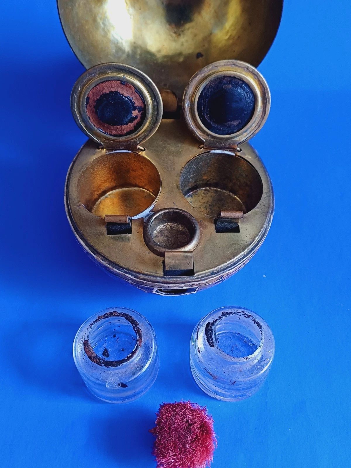
- Airtight Travel Seal: The underside of each internal lid is fitted with a recessed leather or cork sealing pad. The tension from the leaf spring forces this pad tightly against the ground rim of the glass bottle, creating a leak-proof barrier vital for a pocket or travel inkwell.
- Removable Wells: The insert deck features deep cylindrical wells that hold the two molded glass ink bottles securely in place while allowing them to be entirely removed for cleaning or refilling.
Origin
- Maker/Region: While usually unmarked by a specific factory, these specific globe-style novelty pocket inkwells were predominantly manufactured in Germany or Austria. Central European manufacturers cornered the market on lithographed paper-on-brass novelty stationery items during this era.
Dating
Analyzing the cartographic details on these specific lithographed paper gores helps narrow down the print date of the map to the 1890s—specifically right around 1890–1895.
Key geographical and geopolitical clues on the globe point to this specific window:
- The Partition of Africa (Post-1885 / Pre-1900)
- “Sahara” and “Soudan”: In the late 19th century, mapmakers began defining the interior of the African continent following the Berlin Conference of 1884–1885. The text labels “SAHARA” and “SOUDAN” across North-Central Africa are styled exactly as British and German commercial map publishers rendered them in the early 1890s.
- Lack of Formal Colonial Boundary Lines: While regions like “Soudan”, “Arabia”, and “Libia” are clearly text-mapped, the absence of rigid, highly specific colonial colors or borders across Central/North Africa suggests a printing date before the late-1890s/1900s consolidation of French West Africa and the Anglo-Egyptian Sudan.
- North American Boundaries
- “North America” vs. “United States”: Looking closely at the North American continent, the layout demonstrates a clear, unified boundary between British America (Canada) and the United States, utilizing font placements standard for commercial atlases of the 1890s.
- The “Sandwich Ids” Label: The Hawaiian archipelago is labeled as the “Sandwich Ids” (Sandwich Islands). While the term “Hawaii” began appearing with regularity after its annexation by the United States in 1898, European publishers—particularly German map houses printing for the export market—retained the historic British name “Sandwich Islands” on small-scale novelty globes right up through the mid-1890s.
- Middle East and Asian Toponymy
- “Arabien”, “Turkestan”, and “Hindostan”: The use of the spelling “Arabien” (visible near the Red Sea/Aden) strongly points to a plate engraved by a Germanic map house (or directly copied from one), as “Arabien” is the German spelling for Arabia.
- Additionally, utilizing “Hindostan” (or similar archaic regional variants visible near the Bombay label) rather than a unified, modern British “India” on a small commercial globe is a textbook signature of 1880–1895 cartography.
- Antarctic Tracking
- “Wilkes” Land / “Graham L.”: On the southern hemisphere segments, references to “Wilkes [Land]” (discovered by the US Exploring Expedition) and “Graham L.[and]” are visible. These were the primary charted points of the Antarctic coastline during the “lean years” of Antarctic exploration, just before the massive boom of the “Heroic Age of Antarctic Exploration” (which kicked off with the Discovery Expedition in 1901 and completely redrew polar map plates).
Conclusion on Dating
Because a miniature novelty item has a very limited surface area, publishers relied on simplified, established atlas plates from their inventory. The cartographic evidence—retaining names like Sandwich Ids, the German-derived spelling of Arabien, and the specific labeling of the African interior—firmly places the design and printing of these paper map panels between 1890 and 1895.
For a similar example, see this Inkipedia entry: Traveling Inkwell, Globe – The Society of Inkwell Collectors (SOIC)
Sold for $300 in June 2026
Content disclaimer. The information posted is the owner’s best knowledge and may not have been vetted by the SOIC. We welcome comments, corrections, and additions, working to make our website information comprehensive and accurate.
Join the Society of Inkwell Collectors (SOIC) – it’s free!
Founded in 1981 as a non-profit organization,
we are documenting inkwells (and accessories).
We’re here to help and inform!